About Westleton
Westleton is a vibrant village with a population of approximately 349 people (census 2011). It is located north of Leiston and north-east of Saxmundham near the North Sea coast.
The village is on the edge of the Suffolk Sandlings, an area of lowland heathland. It is largely surrounded by agricultural farmland. To the East and South lie the Suffolk Coast and Heaths, and nature reserves which are joined to the village by the Westleton Heath Nature Reserve. RSPB Minsmere reserve is also 1 mile immediately east of the village.
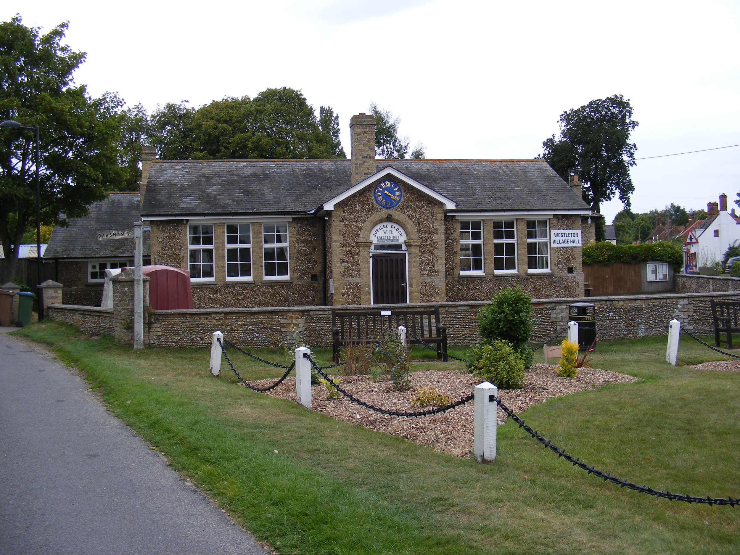
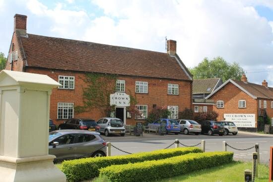
Westleton high street is predominantly populated with a mix of Victorian and Edwardian dwellings and public buildings, with a few more recent additions dotted within the centre and on the fringes. It has a local village hall which is frequently utilised for many uses including film clubs, jazz nights, carpet bowls & council meetings, to name but a few. The village is also served by two pubs - The Westleton Crown which is across the road from Glebe Meadow, and The White Horse Inn. As well as public houses, the village also benefits from a church, a post office, two book shops, a tea room and a car garage.
Site location
The site (highlighted in pink on the map below), once belonging to the grounds of the church, is a 2.2 (approx) acre plot on the Western fringe of the village. It is accessed via a small lane from Darsham Road next to the Village Hall which is a focal point North from the centre of the village. To the West of the site lies wheat fields, and to the North a relatively recent housing development. Directly to the South of the site is St. Peters Church. The site itself incorporates the former vicarage to the church and its own residential curtilage including an area of land known as The Glebe to its rear (west).

Site Location Plan (not to scale)
Site Features:
The main building on the site is the Vicarage, sited centrally and is currently rented out as a private residence. There are also a further two buildings on the site, a single storey solid soft-red brickwork studio, and a small timber framed and timber clad garage.
The site is divided into a series of external areas. To the front of the site is the former front lawn of the vicarage. It is now under grazing rotation by the resident’s horse. The area to the South of the vicarage would have also been a lawn. The area borders onto the churchyard to the South (with a mature tree line) and the Glebe land to the west (with an overgrown hedge line). This area is currently left as scrub with a lone Oak at its centre.
To the West of the site is the Glebe land, which is now open paddock, however has historically always been used in conjunction with the occupation of the vicarage. To the North of the vicarage is a large London Plane tree. The tree is stands prominently next to the vicarage and shades its surrounding area. The space around is currently used as an access and parking area and external storage space for the vicarage.

Glebe Meadow
Site Analysis:
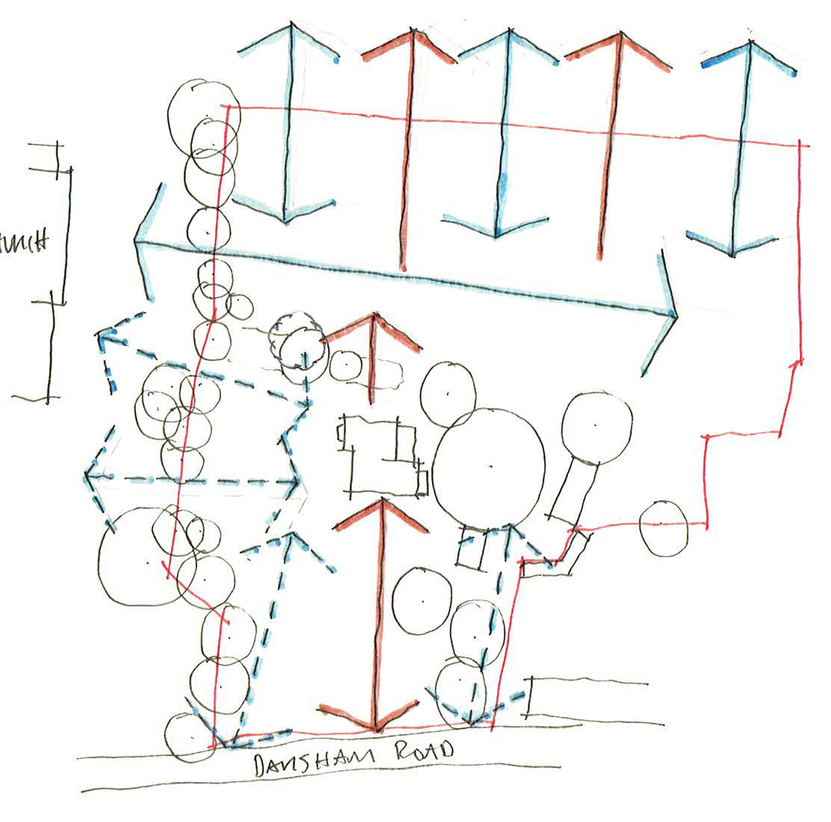
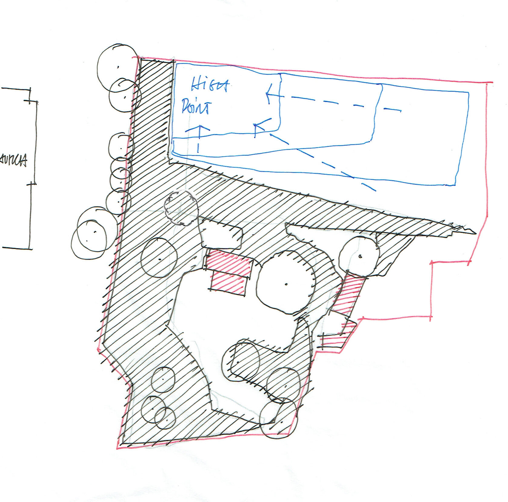
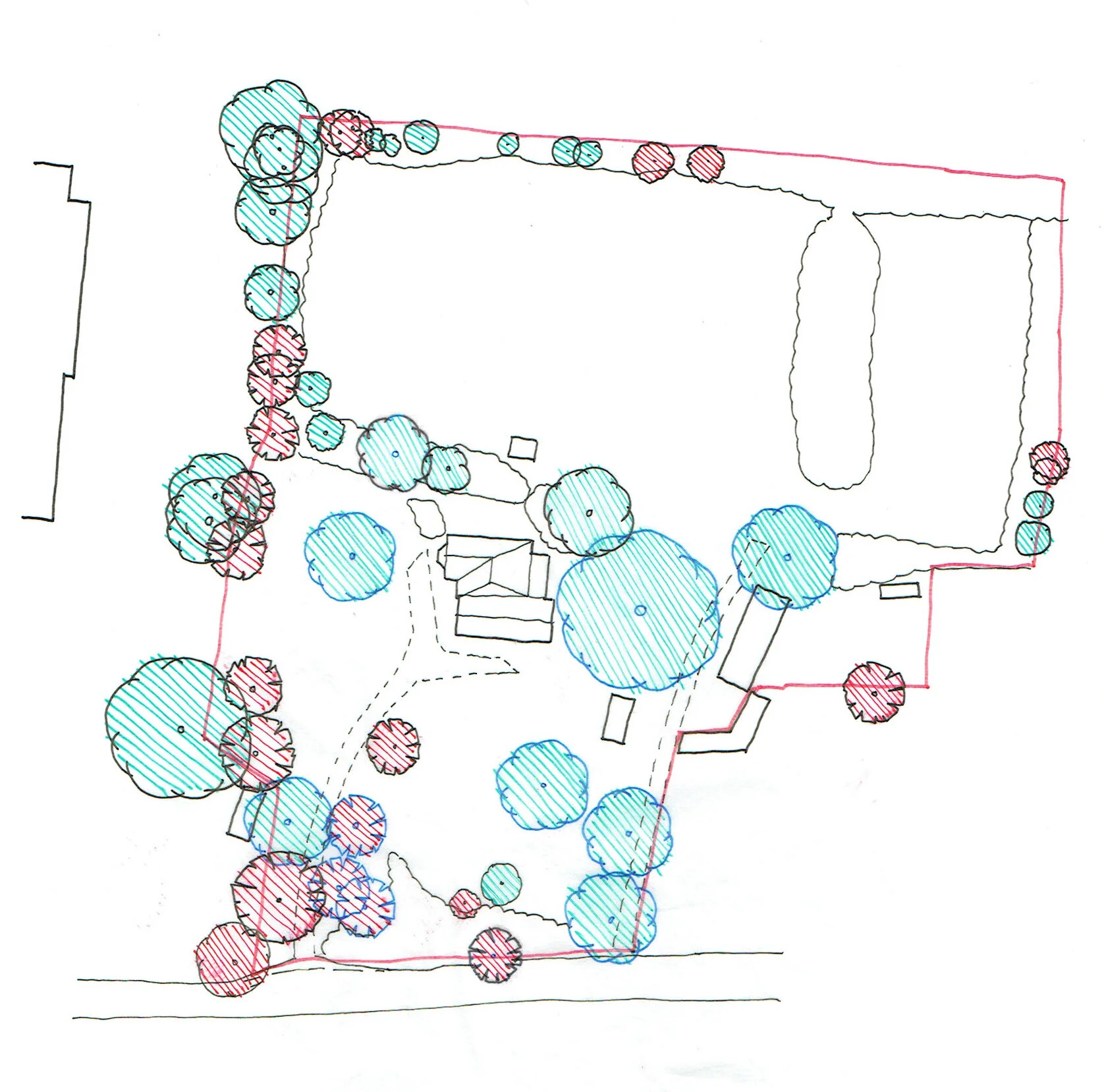
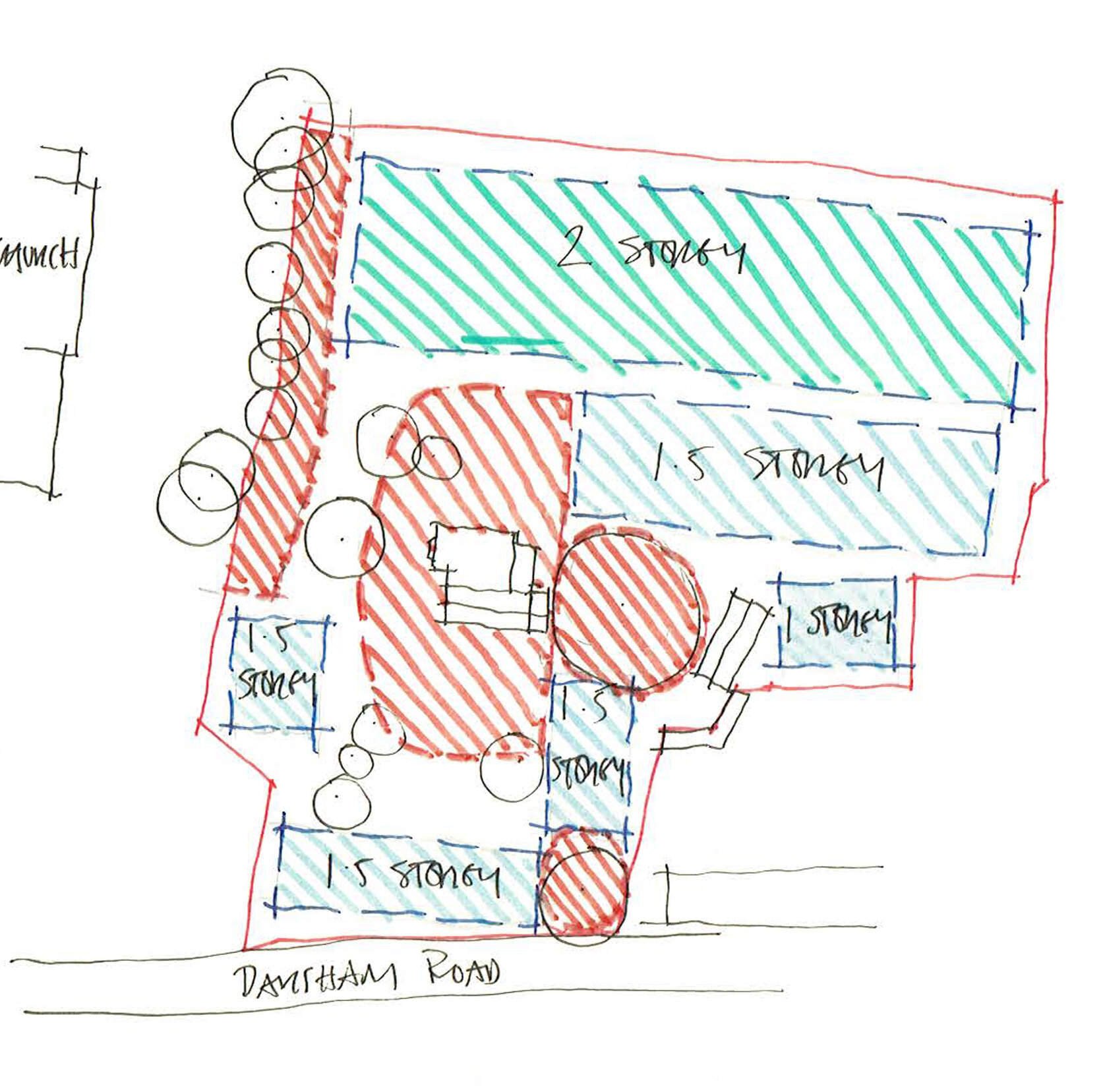
An initial set of sketches has been derived from site visits which explore key potential drivers for design.
One of these design drivers is the placement of existing significant trees, and the framed view lines that these create across the site. A tree survey has been carried out and analysis of this can be seen below.
Exposure of the site was also explored, and the study conveys the exposure experienced through relative isolation/shading and elevation. The last diagram is an initial study of potential development areas.